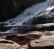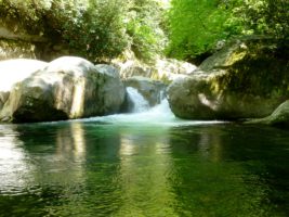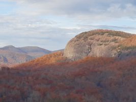
Looking glass rock

Hanging out on a Pluton


Autumn at Looking glass rock

What it the world is a Pluton?

Plutons are magical places in our ancient hills.  They are like huge rock bubbles that you can climb up to get some of the most spectacular views in the Blue Ridge.  The above picture is a view from John’s Rock overlooking another pluton, called Looking Glass Rock.  On this hike, Tom and I got to witness 2 beautiful bald eagles flying below us and fishing on the river.

This is a day trip from our cabins.  We actually left about 10 am and stopped in Waynesville, NC to grab some lunch at our favorite burger joint, the Church Street Depot, then off to the Shining Rock Wilderness area on Hwy 276.  This takes you past the Cradle of  Forestry, Sliding Rock and Looking Glass Falls to name just a few places along the way. So, leave earlier if you want to visit these along the way, then you will have the whole day to enjoy this area.  There is much to see.  The trailhead to both the plutons is just past Looking Glass Falls on forest service road 475 C which will be on your right.  Looking Glass Rock trail is on the right and then John Rock is on the left at the Pisgah Wildlife Center and Fish Hatchery.

The Best Views in the Blue Ridge are from the Top

We love the plutons.  There are two that you can climb. Although it is a bit of a challenge and fairly steep in places,  both trails are worth the climb.   These pictures are from our hike along the loop trail at John’s Rock.

Hiking Suggestion

Make sure you check the map at the kiosk at the trailhead so that you note the proper turns.  The trail is well marked with signs. The loop is explained in the link above.  It will take you by Cedar Rock Falls which is a beautiful spot to take a break, or a swim if it is warm enough.
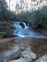
Cedar Rock Falls

Looking Glass Rock: A  Vertical Challenge

Looking Glass Rock trail is more challenging, longer and steeper than the John Rock trail.  It is a spectacular climb for those who like to climb.  Therefore, this trail can be challenging and rocky in place.  Also, one must navigate some pretty rough and washed out places on the trail. However, the views are definitely worth the effort.

In addition, this is a coveted place for rock climbers.  Also, it is a rare nesting place for peregrine falcons. If you are lucky you will see them dive.  They are spectacular.

Looking glass rock


Paint Creek

Great Hiking, Biking and Swimming
Can be combined nicely with dinner or lunch in Hot Springs
Picnic tables available by the creek
Waterfalls, Beautiful Rocks, Views of the River, Picnic opportunities

To access this general area:

Drive to Hot Springs on Hwy 209 N.
Go through town and cross the French Broad River
Immediately after you cross the river, turn left to access River road.
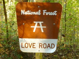
At the stop sign, turn right to head downstream.Love Road is so romantic
This road takes you several miles down the river on a very scenic drive.

In a few miles, it will turn to a dirt road. Then you will come to Murray’s Branch Recreation area.
The parking lot is on the left and the trail begins on the right of the road, just before you enter the parking area.

Hiking at Murray’s Branch
T & R Rating
Moderate
Yellow Blazes
1.3 miles
This short loop has gentle switchbacks through the forest up the ridge. About 3/4 mile in you will come to a Y. This is the loop. Stay to the right to see incredible ridgetop views of the river. Continue on and this trail joins with another trail, that has blue blazes. It winds on in the woods but does not loop. You can add to your hike with this “in and out” section.

Paint Creek to Dudley Falls
Paint Creek Road is very passable, but is narrow with turnouts. You will have a choice to take the high road or the low road.

The upper road is best done in a 4-wheel drive vehicle.

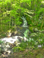
The low road takes you to Dudley Falls. It takes you by a beautiful creek with lots of picnic opportunities. Dudley falls is a beautiful waterfall that is accessed by car. This is a great place to wander around and dip in the creek.

The campground is 5.5 miles up the paved road. There is a loop hiking trail that starts there.

We love to park at the bottom of the paved road and ride our bikes up to the campground and back. It is a lovely ride by the creek.

Shelton Laurel Area Hiking Pisgah National Forest

Swimming Holes in Shelton Laurel

We have just started exploring this area and we find it quite beautiful.
The trails here are remote and are more for those experienced in back country hiking.
Most require a drive up a forest road to get to the trail heads. This is not a well traveled area, so sometimes the trails are a little harder to read. It is important to know about trail safety and back woods travel before attempting these hikes.

Hickey Falls
T &R Rating
Excellent
2.3 miles one way (best done as in and out unless you know how to loop it with White Oak Trail) It is not well marked on how to do this loop. But the In and Out is easy to follow.
Difficult

This hike is very scenic. It is especially nice when the rhododendrons are blooming. The trail leaves FR 465 right at a gate. You cross the creek on a really nice bridge and follow the trail through the woods. It then joins the creek again and offers the traveler many chances to dip it some wonderful swimming holes. The falls are gorgeous and well worth the climb. The Trail continues past the falls, but we don’t advise this unless you are heading on to connect with another trail. It is very, very steep. If you turn around at the top of the falls, the hike is very pleasant back to the starting point.

To get to the trail head, go to Hot Springs and Follow 25/70 East towards Marshall. When you get to The Laurel River Store and where 25/70 takes a hard right at the river, turn left on 208 to to 212 and turn right. Drive until you see the brown sign for Hickey Falls trail. Turn left of FR 465 and follow the road up to the gate. The gate may be open or closed, but the trail head is right there.

Midnight Hole at Big Creek, excellent swimming hole

Hiking Big Creek in the Great Smoky Mountain National Park

Tom and Rebecca Rating
Excellent Hiking

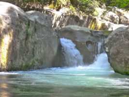
Midnight Hole at Big Creek, excellent swimming hole

Easy Trail
2 miles in and 2 miles out Excellent Swimming Hole…..Our Favorite!!!!
Excellent Jeep Trip (Call for directions)

One of our favorite places to go on a hot summer day is Big Creek. This creek offers great swimming holes and fishing holes. It has a nice gentle hike to 2 beautiful waterfalls.
We love to go here and cook a little lunch in the picnic area then go up to the falls for a dip.
The trail takes off from the picnic area. About a mile up if you look very carefully to the right you will see a trail that is not marked that goes up through some big rocks. About 100 ft up you will find an amazing and unique cave. It is work the climb.
However, if you are just enjoying the gentle hike, continue on up the main trail and look for a well traveled path to the right that leads to Midnight Hole. This is a glorious place to swim. Perhaps Rebecca’s favorite, as it offers a nice wide pool and the water is so clear you can see the fish swimming with you. Also, hearts appear here in the rocks as the sun changes position. It is really and amazing place.
Further up the trail is Mouse Creek Falls. This is also a beautiful waterfall and worth the extra half mile walk.
There are many different ways to get to Big Creek from Dancing Sun Cabins.
The Google map shows a way via Max Patch that includes dirt roads.
But, if you want to go the paved road way, see the directions below.

From Dancing Sun Cabins:Big Creek Waterfall

Take Roaring Fork to Meadow Fork and Turn Right
Go 3 miles to Caldwell mountain Road and Turn Left
Go to the end of Caldwell Mountain Road and turn Right on Hwy 209 S
Travel until you come to Furgeson’s store where Hwy 209 turns Left, but instead turn Right to go toward
I-40W. Turn Right on Fines Creek Road and Follow it as it bares left toward I-40.
Take I-40 W to exit 451 (Waterville Exit)
Turn left after crossing the Pigeon River and continue 2.3 miles and continue straight through the intersection past the ranger station and continue on to the picnic area. The trail head is at the picnic area. Big Creek favorites, can you see the heart?